Dispersed camping near Mt Hood and Mt Rainier
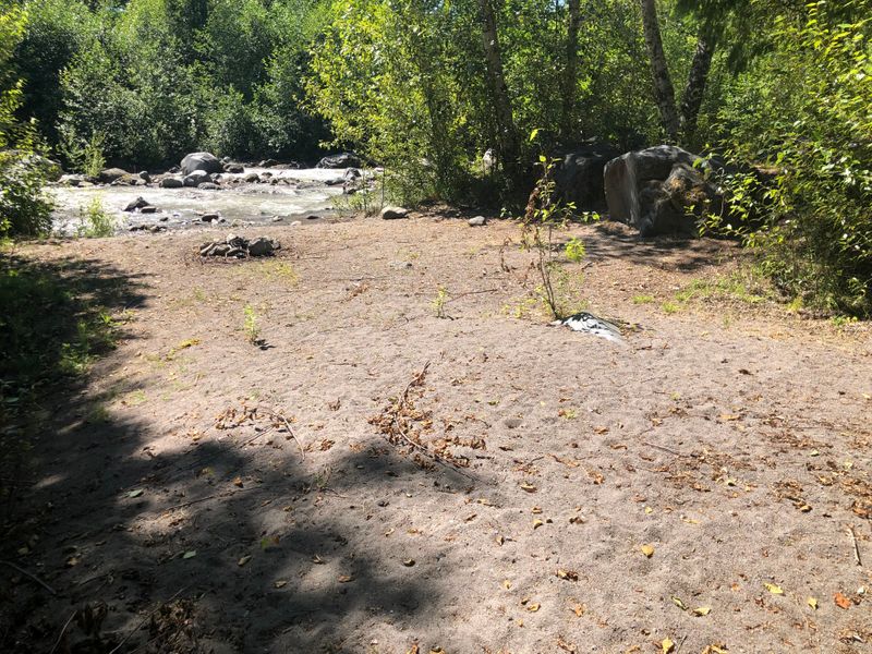
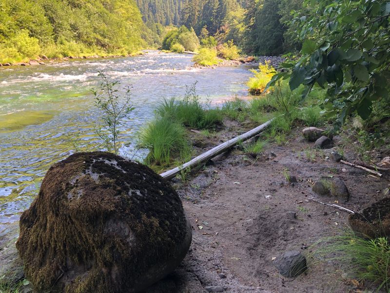
Most of the spots on our map are not in any campground. They are the places people have pitched a tent for years beside a river: a flat of sand, a clearing under the firs, a ring of river rocks someone left behind. In 2019 and 2020 we photographed these on national forest land, in the places where there were enough of them to be worth a page each.
There is nothing there and nothing to pay: no toilet, no tap, no table. What you need to know is where they are, what the rules are, and whether your car will get you there. That is this page.
Where they are
Dispersed camping on the Sandy River near McNeil
89 free places to pitch a tent along the Sandy River below Mt Hood, outside any campground, each with our photo and most with a 360° view. 59 of them are within 500 feet of the river.
Dispersed camping on the Clackamas, before the fire
Photographed in July 2019, a year before the 2020 Riverside Fire burned across this ranger district; in 2026 the Austin Fire closed part of it again.
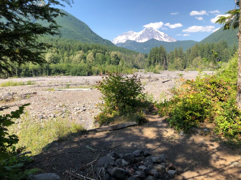
Dispersed camping on the Nisqually River below Mt Rainier
Nine places to pitch a tent outside any campground on the Nisqually River and Berry Creek, just outside Mt Rainier National Park, each with our 2020 photo. Five sit above the river’s gravel bar, less than a mile from the Nisqually Entrance.
Will your car get there?
61 of the 113 are reached on paved roads kept up for passenger cars. 40 are on dirt or gravel roads kept up only for high-clearance vehicles. 12 are in between.
That is the Forest Service’s own sorting. A road it maintains at level 3 or above is kept “for travel by a prudent driver in a standard passenger car”; a level 2 road is only “open for use by high clearance vehicles”. It tells you how a road is kept, not what it was like last week, and some of these spots are a walk from any road.
The Sandy River near McNeil
- Off Forest Road 1825-043 (33): Off paved Forest Road 1825 onto the 1825-043 spur, a dirt road the Forest Service keeps up for high-clearance vehicles, not passenger cars. The spots are from about 230 feet to half a mile down it.
- Along Muddy Fork Road (FR 1825) (27): Forest Road 1825 is paved and kept up for passenger cars. Most of these are within 400 feet of it; four are 600 to 1,400 feet away in a straight line.
- Along East Lolo Pass Road (FR 18) (14): East Lolo Pass Road is paved here and kept up for passenger cars. Nine of these are within 460 feet of it; the other five, the four by the river among them, are 800 to 1,600 feet away in a straight line.
- Around the Ramona Falls trailhead (9): In between. In the Forest Service’s road records the way in is paved and kept up for passenger cars until the last tenth of a mile into the trailhead, which is dirt; its trailhead page calls the road rough and recommends high-clearance vehicles. The spots are up to 560 feet from the road.
- Up the other forest roads (6): Three are just off paved roads kept up for passenger cars: the Ramona Falls trailhead road and Last Chance Mountain Road (FR 1828). The other three are just past Riley Horse Camp, 650 to 1,100 feet beyond the end of the paved road, on a road the Forest Service’s records do not include.
The Clackamas River before the 2020 fire
- Along Highway 224, from the South Fork to Roaring River (5): Right off Highway 224, which is paved, all within 300 feet of it.
- Below Ripplebrook (4): Three just off Highway 224 and one off Forest Road 4620, both paved, all within 150 feet of the road.
- Past Ripplebrook, toward Lake Harriet (6): All six are on Forest Road 4630, which the Forest Service keeps up for high-clearance vehicles, not passenger cars. The three in the woods are on a short paved piece of it, about 1,000 feet from paved Pint Creek Road (FR 4631); the three toward Lake Harriet are 1.2 to 2.5 miles further on, on gravel.
The Nisqually River below Mt Rainier
- On the Nisqually, off Forest Road 52 (5): Forest Road 52, Skate Creek Road, is paved (chip seal) and kept up for passenger cars. All five are within 300 feet of it.
- Up Berry Creek (4): Three are off Forest Road 52, paved: one right by it, two 660 to 820 feet from it in a straight line. The fourth is about 1,400 feet up Forest Road 5220, gravel, which the Forest Service keeps up for high-clearance vehicles, not passenger cars.
The rules
Both forests ask much the same.
- Nothing there, and no fee. No toilet, no drinking water, no fire ring, no trash service. That, Mt Hood says, is why there is no fee; Gifford Pinchot’s page does not mention one. Bring water, or a way to treat it, and take everything home.
- 14 days, then move. Up to 14 days in a row in one place, and no more than 28 days a year anywhere on the forest. Both forests have the same order.
- 100 feet from the water. From streams, rivers and lakes, on both forests. By the map, 13 of our 113 spots are closer than that: that is where people have camped, not where the rule says to. Pitch your tent back from the water.
- Fires. Burn only wood that is already down, never cut a tree, and never leave a fire until it is cool to the touch. On October 24, 2026, neither forest listed fire restrictions in its alerts; check again before you go.
- The toilet. A hole 6 inches deep, at least 100 feet from any water, and no toilet paper left on the ground.
- Where you can’t. Not inside developed recreation sites such as campgrounds, along certain roads, or in particularly sensitive areas, and not in parts of the wilderness on Mt Hood. On Gifford Pinchot, keep out of fragile meadows, and drive only where its Motor Vehicle Use Map allows. The ranger district can tell you where.
- Groups. On Mt Hood, under 75 people; a bigger group needs a permit from the ranger district.
Before you go
Look at the forest's alerts for closures and fire restrictions: Mt Hood National Forest and Gifford Pinchot National Forest. Each area page has what we found when we last checked it.
Would you rather have a campground? The campground guides say which site to take at 22 of them, and the sites by the water near Portland are on a page of their own.
The spots are every one we photographed in each area. Distances to the water are straight lines from each pin. The roads are OSRM's route from Portland City Hall to each pin, laid over the Forest Service's own road records, and the drive times are without traffic, so a summer Friday is slower. Checked October 2026 with Forest Service: Mt Hood dispersed camping, Forest Service: Gifford Pinchot dispersed camping, Mt Hood alerts, Gifford Pinchot alerts and the Forest Service’s road records. Been there since? Tell us what has changed: support@tentspots.com.